Distribution of mangrove forests in Cambodia
Published by: Open Development Cambodia
Data Resources (7)
Data Resource Preview - Distribution of mangrove forests in Cambodia
Additional Info
| Field | Value |
|---|---|
| Dataset topic category | Environment and natural resources |
| Language |
|
| Use limitations | Dataset is restricted by the user constraints as outlined by UNEP-WCMC General Data License, http://www.unep-wcmc.org/policies/general-data-license-excluding-wdpa%20-%20data_policy. |
| Dataset reference date | July 4, 2011 |
| GeoNames |
|
| West bounding coordinates | 102.914924621582 |
| East bounding coordinates | 104.547203063965 |
| South bounding coordinates | 10.4023275375366 |
| North bounding coordinates | 11.7796010971069 |
| Spatial Reference System | WGS 84 (EPSG:4326) (CRS:84) |
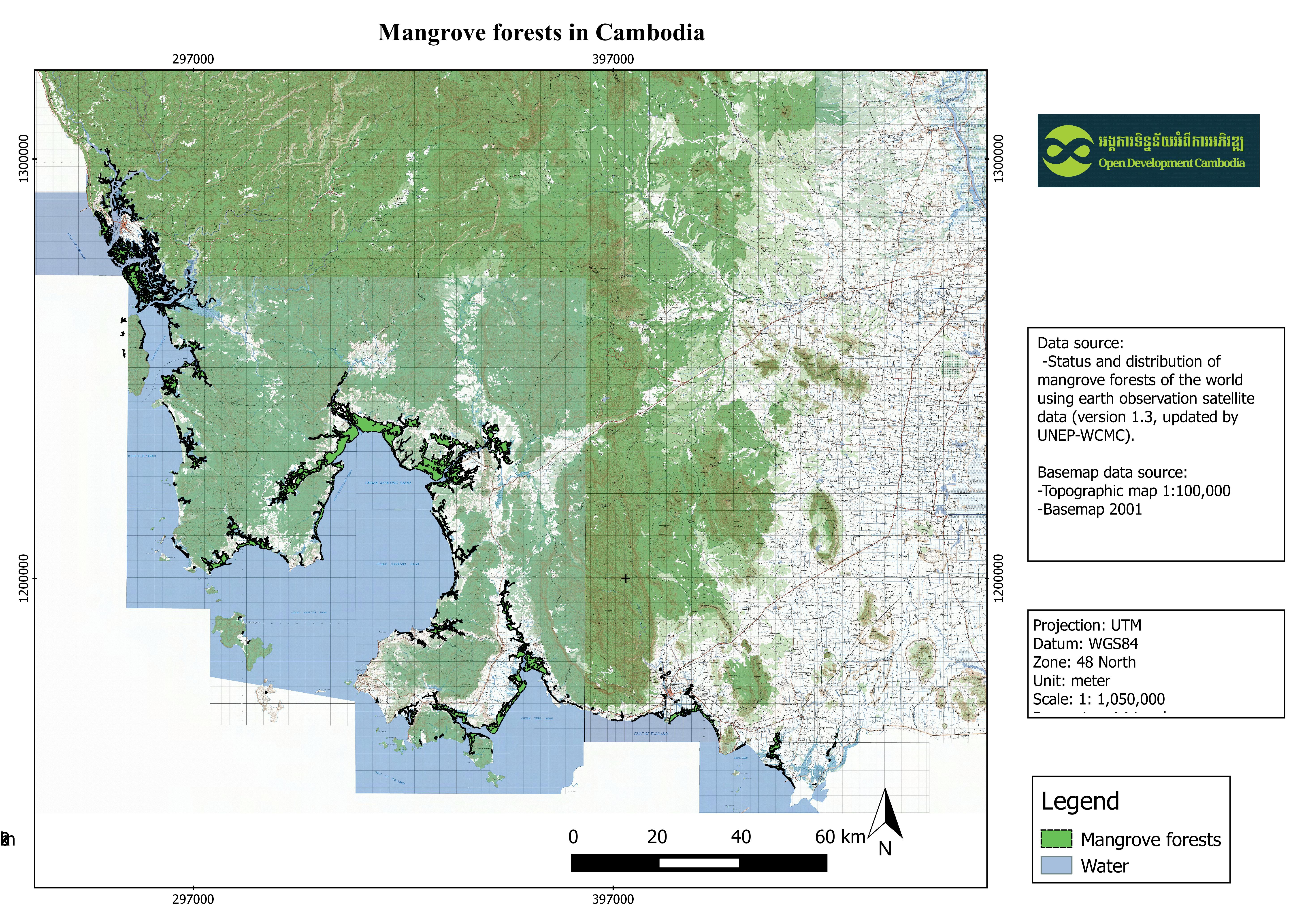
| Process Step | This dataset shows the distribution of mangrove forests, derived from earth observation satellite imagery for the Greater Mekong Subregion. Then it was clip by cambodia region by QGIS application. |
| Lineage | Giri C, Ochieng E, Tieszen LL, Zhu Z, Singh A, Loveland T, Masek J, Duke N (2011). Status and distribution of mangrove forests of the world using earth observation satellite data (version 1.3, updated by UNEP-WCMC).Global Ecology and Biogeography 20: 154-159 ; http://data.unep-wcmc.org/datasets/4 |
| Responsible party | UNEP World Conservation Monitoring Centre Address: #219 Huntingdon Road, Cambridge, CB3 0DL, United Kingdom Contact: +44 (0)1223 277314 |
| Metadata creator information | Metadata last updated on 2016-08-03. For inquiries contact: Open Development Cambodia Address: #43 St. 208, Phnom Penh, Cambodia. Email: contact@opendevcam.net Website: http://www.opendevcam.net |
| Attributes | AREA_KM2: Areas in square kilometer; AREA_M2: Areas in square meter |
| License | CC-BY-4.0 |
| Copyright | Yes |
| Version | 1.3 |
| Date uploaded | August 2, 2016, 07:11 (UTC) |
| Date modified | June 28, 2023, 01:48 (UTC) |