Water bodies in Cambodia
Published by: Open Development Cambodia
Data Resources (7)
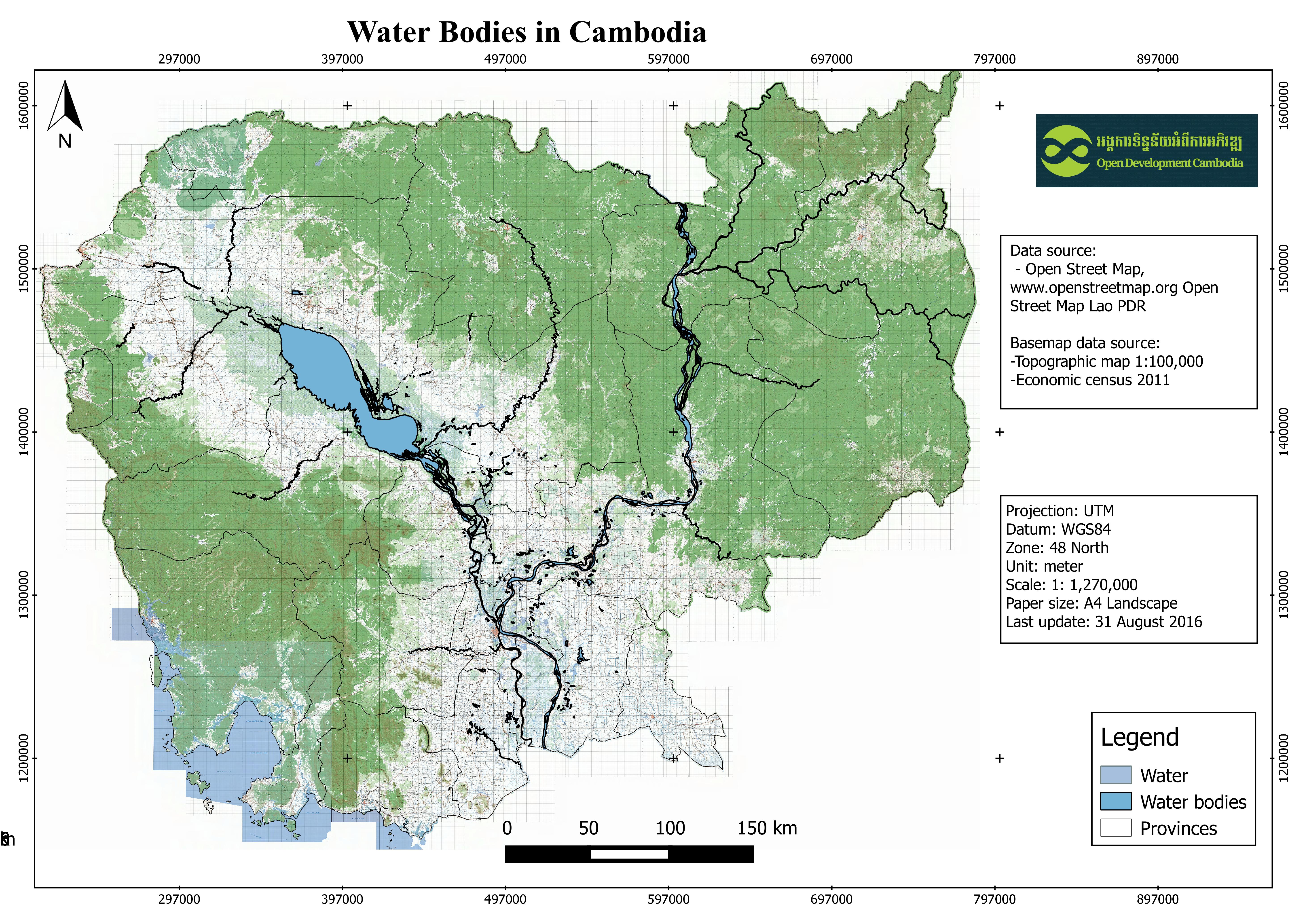
Data Resource Preview - Water bodies in Cambodia
Additional Info
| Field | Value |
|---|---|
| Dataset topic category |
|
| Language |
|
| Use limitations | Access and use constraints are depend on Open Street Map Lao on the website: http://www.openstreetmap.la/ |
| Dataset reference date | November 11, 2015 |
| GeoNames |
|
| West bounding coordinates | 102.551643371582 |
| East bounding coordinates | 107.88102722168 |
| South bounding coordinates | 10.287540435791 |
| North bounding coordinates | 14.3942861557007 |
| Spatial Reference System | WGS 84 (EPSG:4326) (CRS:84) |
| Process Step | Open Development Cambodia downloaded the data in shapefile formart as the regional level then it was clipped for Cambodia country before using a web-based tool, CartoDB, to visualize the polygon data. |
| Lineage | Open Street Map, www.openstreetmap.org Open Street Map Lao PDR, http://www.openstreetmap.la/ |
| Responsible party | Open Street Map, www.openstreetmap.org Open Street Map Lao PDR, http://www.openstreetmap.la/ |
| Metadata creator information | Metadata last updated on 2016-08-09. For inquiries contact: Open Development Cambodia, Email: contact@opendevcam.net, Website: http://www.opendevcam.net Address: 43 St. 208, Phnom Penh, Cambodia |
| Attributes | osm_id:OSM code number; waterway:waterway; landuse:landuse; natural:natural; name:name; source:source |
| License | CC-BY-4.0 |
| Copyright | Yes |
| Version | 1.0 |
| Date uploaded | August 8, 2016, 09:50 (UTC) |
| Date modified | October 12, 2022, 04:57 (UTC) |